YOU are looking at the
specialty Map case
Presented by the
Historical Preservation Society of the Upper Keys
THIS AND THE FOLLOWING PAGES ARE UNDER CONSTRUCTION
Please visit but realize they are not finalized.
Single click a selected map listed below to go to its index
A
Gulfstream
Map
Another
Gulfstream
Map
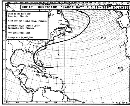
1935
Hurricane
Path
Location
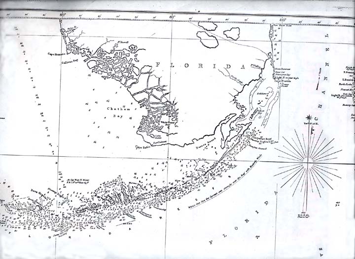
of
Lightship
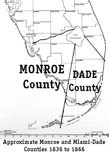
1836
Dade and
Monroe
boundaries
1837
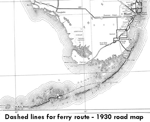
1930
Ferry
Route
Return to Map Room
E-mail to editor
Return to Cybermuseum