
- General Keys History
- Early Land Ownership
- By Jerry Wilkinson
- It is probably difficult to realize that at one time land in the Florida Keys was difficult to legally own with complete assurance of ownership. Except for the purchase of Spanish land grants it was virtually impossible to do so until the 1870s. The following are a few of the milestones of Florida and Keys land ownership.
In the early times under the native Florida Indians, there was no ownership of land. The Indians' thinking was that the land belonged to everyone as a part of nature. This caused immediate problems when the Europeans arrived and claimed title to all the land.
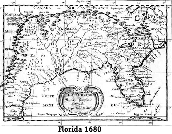
Ponce de Leon departed San Salvador on March 27, 1513, the Day of Resurrection Passover (Easter) then commonly called Pascua de Flores. He anchored near the shore of Florida on April 2, 1513 and claimed Florida, which was shown on most early maps as all the eastern United States, in the name of Spain. Quoting from James Kelly's translation, ". . . They called it La Florida, because it was very pretty to behold with many and refreshing trees and it was flat, and even, and also because they discovered it in the time of Flowery Passover, Juan Ponce wanted to agree in the name, with these two reasons. He went ashore to speak with the Indians, and to take possession. Friday the 8th they set sail, . . ." To view a 1680 Florida map Click HERE, and use the back arrow to return.
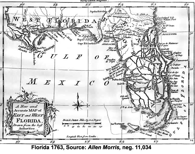
The Indians' rights were never considered. It was just that easy, but not as easy to hold. Therefore, Florida became land owned and governed by the Crown of Spain in 1513, traded to England in 1763, taken back by Spain in 1783 and sold to the United States in 1819. Its size gradually shrank. To view a 1765 Florida map Click HERE, and use the back arrow to return.
While under the second Spanish ownership period, the Crown gave various land grants to special people, often in lieu of some payment, service rendered, or as an inducement. Present-day Key West and Marathon were Spanish land grants. Key Biscayne to our north was also a Spanish land grant to Pedro Fornells. There were no English land grants in the Keys.
Final ratification of the Adams-Onis treaty of 1919 and the transfer of flags making Florida a U.S. Territory occurred on February 22, 1821 - the United States owned Florida. This terminated ownership by the Crown, but some previous Spanish land grants were declared valid. Special land commissions and judicial tribunals were established to determine the validity of each Spanish land grant. All other land was owned by the U.S. until ownership was transferred in some manner.
Following a brief period of military government, Congress approved Florida as a Territory with William DuVal as its governor. On March 4, 1824, Tallahassee was selected the capital for it was located in the center of Florida's population, namely Pensacola and St. Augustine.
Land ownership in the Keys is vague during the territorial period except for Key West, Marathon and four islands off of Marathon, which were valid Spanish land grants. It appears that throughout the rest of the Keys people just squatted on whatever federal land they wanted.
A grant application for 24,000 acres was made by the Coffee Land Company and sent to the House of Representatives on February 20, 1822. The specifics of this request as detailed would have included all of Key Largo and four sections of present-day Dade County. The name selected by the group was "Monroe's Presque Isle." The grant was never approved.
We know that Key West was a valid Spanish land grant to Juan Pablo Salas in 1815 and sold to John Simonton of Mobile, Alabama in 1822 for $2,000. The city was surveyed in 1829 by William Whitehead, which resulted in an accurate map for land ownership.
Key Vaca (Marathon) and four small islands were Spanish land grants to Francisco Lorenzo Ferreira in 1814, who sold Vaca Key to Issac Cox of St. Augustine in 1824 for $3,000. Duck Key was sold by Francisco Ferreira to Solomon Snyder of New York in 1823.
The mercantile company of Snyder and Appleby sent Silas Fletcher to Indian Key to build a store in 1824; however, it is not known how they thought, if they did or needed, that they had good title to the land. The 12-acre island was eventually sold to Jacob Housman for $5,000, whose claims after the 1840 massacre were denied allegedly because of lack of proper land ownership evidence. The type of land ownership could have been been obtained via a "Pre-emptive Rights Claim" as it had not yet been surveyed. The federal pre-emptive claim bill was signed into law in 1826. This would have been only a preemptive right or first claim to purchase the land should and when offered for sale. One had to pay for the land upon filing for rights; therefore, squatters usually waited for the sale announcement before submitting the claim. One established his or her claim by building a house and working the land. It did not give or guarantee title. Housman also had petitioned for a direct land grant. Later, the Navy moved their base from Tea Table Key to Indian Key and the Housman's heirs were denied compensation for losses. The government ruled that they were all essentially squatters - which they were.
After the Second Seminole War, in which Indian Key figured, the government created the Armed Occupation Act of 1842 signed August 4. 1842. The Act was titled "An Act to Provide For the Armed Occupation and Settlement of the Unsettled Part of the Peninsula of East Florida." For a period of nine months, 200,000 acres of land between Gainesville and the Peace River was granted to those who would brave the Florida frontier and risk the possibility of Indian attacks. This encouraged settlers to occupy, clear and use up to 160 acres of the then remote land, provided it was not within two miles of a military post. Populating the state as much as possible meant cheaper, easier and more control of the Indians. In fact, the government thought the landowners, given land ownership, would voluntarily fight the Indians.
Under the above act, by May 16, 1843, eight heads of families had applied to the state registrar of the land office in St. Augustine for armed occupation land permits for Key Largo property. Judge L. R. Mallory signed all the applications. These early prospective landowners were John Lowe, William Lowe, Phillip Baker, William H. Bethel, Samuel Kemp, John Curry, George Curry and John Puke. We are not absolutely certain of the outcome of these applications. From land records, no final land patents appear to have been issued. The lack of an official state survey until the 1870s, some applications being disallowed, or the Keys could have been considered reserved were probably factors. Anyway, only 1,312 permits were approved during the nine months the law was in effect.
After becoming a state in 1845, Florida was surveyed beginning from a marker at the southeast corner of the southeast quarter section where the Capitol building was located. Florida was to be divided into townships of six square miles each north or south of this marker and in ranges east or west of this capitol marker. Each township is six mile by six mile square which would be 36 square miles. The 36 one-square-mile sections are normally numbered top to bottom - starting right to left then zigzaging downward. Each section would contain 640 acres and could be divided into halves (320 acres), quarters (160 acres), half of a quarter (80 acres) or quarter of a quarter (40 acres). The Upper Keys were not surveyed until the 1870s.
The U.S. Swampland Act of 1850 categorized as swamp, or overflowed, 24,000,000 acres of Florida land, and granted it to the State. A summary of Florida Swamplands as of January 1, 1883 to 1894 is as follows:Balance on Hand January 1, 1883 . . . . . . . . . . 14,754,361 Acres
Sales or Grants
Pensacola and Atlantic Railroad. . . . . . . . 3,200,000 Acres
Okeechobee Drainage Lands. . . . . . . . . . . 1,781,051 Acres
Florida Southern Railroad. . . . . . . . . . . 4,000,000 Acres
Jax-Tampa-Key West Railroad. . . . . . . . . . 3,000,000 Acres
Palatka and Indian River Railroad. . . . . . . 1,500,000 Acres
Sales to Settlers. . . . . . . . . . . . . . . 26,690 Acres
Sale to Hamilton Disston . . . . . . . . . . . 4,000,000 Acres
Total Sold or Granted 1 January 1894. . . . . 17,507,741 AcresIf we subtract what the state sold or granted from what it had on hand, the state sold some 2,753,380 acres more than it had.
State surveying was slow to arrive in the Keys. It was not until 1872 that Marcellus Williams set out to survey Key Largo for the State, which he completed in a little over a month. Charles F. Smith surveyed most of the remainder of the Upper Keys from 1872 to 1874. Land ownership for each Key is unique.
For example, Key Largo had around 24,000 acres and of this, 15,235 acres was deeded from the U.S. Congress to the State of Florida from 1845 to 1929. Much of it was covered by the U.S. Swamplands Act of 1850. Florida then either gave the Key Largo land to railway companies (none of which were in the Keys), or sold land outright for state revenue.
Some 11,000 acres of the state owned Key Largo land was given without charge to various railway companies to induce them to construct railroads somewhere else in the state. None was given directly to Henry Flagler.
Homesteaders, under the U.S. Homestead Act of 1862, revised 1866, obtained some 8,400 plus acres of Key Largo land for a $5.00 filing fee plus other required obligations. Land could only be homesteaded if it was surveyed. Federal homestead grants were up to 160 acres, but did not include ocean/bay bottom, so in the Keys the total acreage varied from grant to grant. These were true "Homesteads" as opposed to previously mentioned land grants, pre-emptive right claims and Armed Occupation Act of 1842 claims. Similar claims were filed throughout the Keys.
The Homestead Act declared that any citizen or alien who had filed his intention to become a citizen, was age 21, or was a head of a family, might acquire ownership of a tract of 160 acres, or less, of public land without cost (except the payment of administrative fees) by residing upon the land and cultivating it for a period of five years. A clause permitted the homesteader to acquire title six months after settlement upon payment of $1.25 per acre.
The state sold to early Key Largo settlers the remaining land not homesteaded, some 4,200 acres, for their private use. Probably the first of the early settlers to purchase Key Largo land from the state was Edward Bell, who in 1876 purchased 515.36 acres of Township 60 South, Range 40 East, Section 16 for $580.57. This acreage is about four miles north on CR 905 on the way to Ocean Reef. One corner of Section 16 is part Card Sound water and the opposite corner is the Atlantic Ocean; so he did not actually get the full 640 acres that a Section contained. Mr. Bell was the lighthouse keeper at the Carysfort lighthouse. He was described as age 39 and from England in the 1870 census. No family members were listed.
The first Upper Keys deed for a homestead that I found was by Amos Lowe for 146.26 acres on the south ocean side end of Key Largo (now Tavernier) dated June 10, 1880. His homestead became known as Lowesport but never appeared to be settled as a separate community. Amos and Ada Lowe with three children were also listed on the 1870 census.
So it appears that the state and federal government sold, or gave away, all of Key Largo. There were about 11,000 acres given to the railways, 4,000 acres sold privately and 8,400 acres homesteaded. Of course, now and for some time, both governments have been buying land back for various purposes.
Upper Matecumbe Key is unique in that of the three family pioneer names, there are recorded homestead patents for six different family members.
Other than that connected with Henry Flagler building of the railroad from 1905 to 1912, the next major land phase appears to be in 1924. In 1917, Monroe County floated a $100,000 bond issue to build a road and some trails up and down Key Largo. Then, in 1924, the State started planning a 2,800-foot wooden bridge across Card Sound. The year 1924 was also the year that Key Largo had its first subdivision, known as the "North Carolina Fishing Camp Subdivision," which was located oceanside between mile markers 100 and 101.
Also, with great expectations, R.C. Perky (the same as the bat tower), who was managing director of the Island Holding Company (the largest Key Largo land owner at that time), made the first copyrighted map of Key Largo.
For some reason, the approved dates of the first Upper Keys federal homesteads began in the 1880s, although the land was surveyed in the 1870s. I have the feeling that an obscure Executive Order declaring the Keys a military reservation in 1842 caused the delay while awaiting repeal.
Summary of Florida land ownership events:
? to 1513 = Native Americans
April 2, 1513 = Ponce de Leon claimed for Spain
February 22, 1821 = United States purchased from Spain
March 4, 1824 = Territory of Florida established
1826 = Pre-emptive rights claims signed
August 4, 1842 = Armed Occupation Act passed
March 3, 1845 = Florida Statehood
1862, revised 1866 = Homestead Act.
1872 - 1874 = surveyed most of the Florida Keys------------ Use Back Arrow to return to reading previous page or:
To return to the General History homepage, Click HERE.Return to Historeum